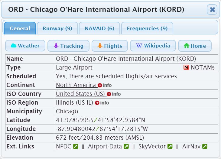
General information of a particular airport, like name and identifiers, continent, country region, and municipality, type of the airport, having flight services, Latitude, Longitude, elevation, etc.
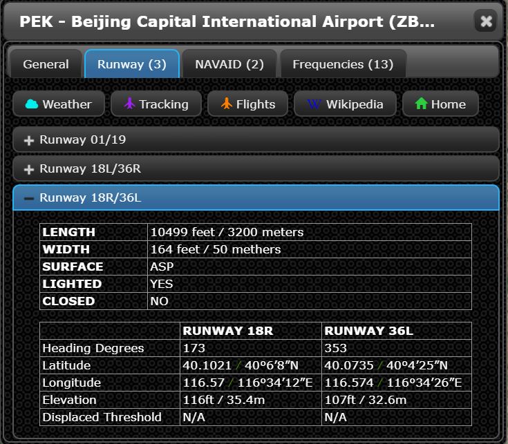
All the runways airport and helipads for heliport are provied, including all the details.
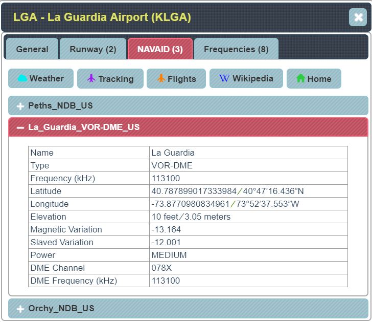
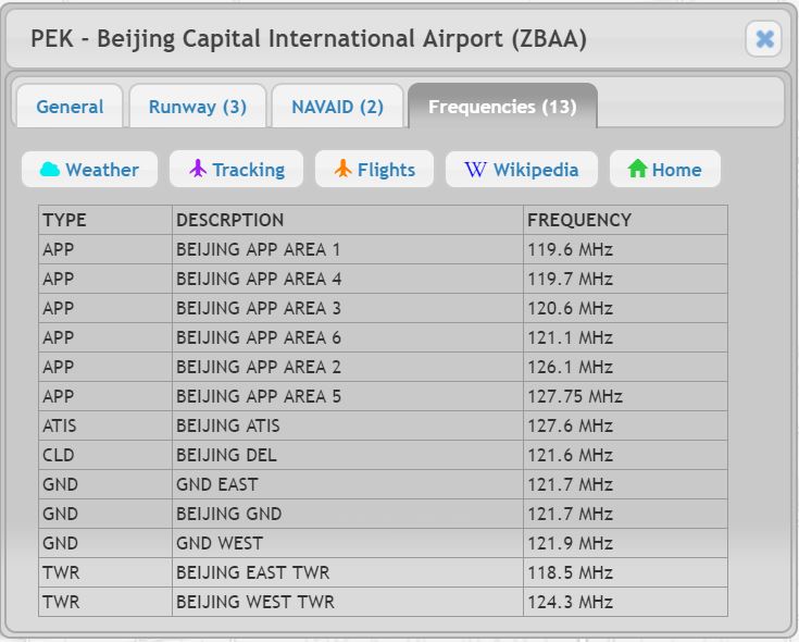
Details of all sssociated NAVAID and Communications Frequencies provided.
You can view up tp 7 days weather at the particular airport. METAR and TAF will be displayed if they are available.
If the airport has scheduled flights services, you should be able to view all the schedules and current status, all real time.
It links to FlightAware.com for real time flights arriving and departing the airport, as well as scheduled arriving and departing in next few hours.
For all airports in the United States, you can view current active NOTAMs for the aiurport.
If the airpirt has a Wikipedia page or an official Homepage, the links will be displayed.
Links to external web pages with information related to the airport are also provided.
Copyright ©2001-. MathThinking Technologies, Inc. All Rights Reserved.
 Airport
Visualizer
Airport
Visualizer